Posts

Showing posts with the label greenway

Edge Inner West 2023 - EDGE GreenWay
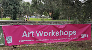
Image
Progam https://www.innerwest.nsw.gov.au/live/living-arts/edge/edge-greenway-2023 creating raw clay fish Flying Green Fish -  Jayanto Tan and Diamando Koutsellis Drop into this site-specific installation and put your hands to work – create some raw clay art which will culminate in a school of fish on the canal. Flying Green Fish examines historical and contemporary issues around environmental impacts and climate change related to fish species’ habitat around the GreenWay canal.  In the container The Long Table You're invited to take a seat at the ‘Table Talk’ and join a discussion exploring the Art in the Anthropocene. Using the setting of a domestic dinner table where talk is the only course, this Table Talk aims to generate an open discussion. Led by artist Maria White , the role of speaker and spectator is interchangeable as anyone can take an empty seat at the table and participate. Table Setting The Anthropocene era is characterised by significant human influenc...

Inner West Greenway (Marion St to Bay)

Image
Consultation on the Blue-Green Grid Strategy. Community feedback dates 16 March -  30 April 2023 "Council is developing a strategy to create a network of blue and green connections across the Inner West to help improve accessibility, recreation, biodiversity, and lifestyle for all. The Blue-Green Grid Strategy will create a plan for providing easy, enjoyable walking and cycling connections between the places you live and work (town centres, schools, public transport hubs) with the places you relax and recharge (harbours, rivers, parks, playgrounds). The Strategy will provide a detailed plan for how we can connect areas of high environmental value, providing more viable areas of habitat and links to scenic landscapes. Popular walking tracks along the Cooks River and Sydney Harbour will be enhanced and complemented by improved connections through tree-lined streets and established urban parks." https://yoursay.innerwest.nsw.gov.au/planning-inner-wests-blue-green...

Walking from Iron Cove to the Cook's River

Image
The walk from Iron Cove to the Cook's River is about 7km.  At Cooks River, 2018 It is well connected to Buses along Parramatta Road, Light Rail between Leichhardt North and Dulwich Hill and Heavy Rail at Lewisham and Dulwich Hill. There have been some changes since I did the Leichhardt to Cook's River by Folding Bicycle in January 2010. Since then the light rail has been extended to Dulwich Hill and there has been development at Lewisham and Summer Hill. 2018               Leichhardt to Cooks River by folding Bicycle January 2010   Pocket Park , Welcome relief on a shady Footpath   Historic Railway Bridge Muse Cafe, Summer Hill Disused Railway line and Mungo Scott Flour Mill   Hoskins Park Gates at the top of public walkway steps Crossing the Cooks River and Marrickville Golf Course Cricket on the Banks of the Cooks River Cooks River Lewisham West,Jan 2010 2018 Light Rail, Lewisham West, Nov 2018 2018 2018 Taverner's Hill2018...

COVID-19 Walk Summer Hill and Haberfield

Image
Summer  Hill, 17 May 2020 Map of Walk   & Instagram Photos N Haberfield to Dobroyd Canal, 19 May 2020 map There is a proposal from Sydney Water to "naturalise" ironcove creek between the bay and Ramsay Street Iron Cove Creek (Dobroyd Canal) Naturalisation Cotton Harlequin Bug Map of COVID 19 Walks