 |
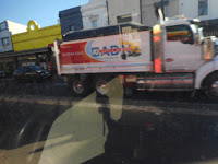
Parramatta Rd, Annandale
|
Recapping on road safety in the Inner West.
Balmain Peninsular has had a blanket 40k speed limit on their roads forever.
 |
Parramatta Rd, Annandale
|
There are also several High Pedestrian Activity Areas, with 40k speed limits, which were implemented by Leichhardt Council - Booth St, Annandale; Norton St, Leichhardt and Styles St, Leichhardt.
Numerous 40k School Limits apply across the State including in the Inner West LGA including on what are 50 and 60k roads outside the School Zone hours. For example on Fort St High, Parramatta Rd and Annandale Public on Johnston St.
 |
Parramatta Rd, Stanmore
|
State Roads (Parramatta Rd, Victoria Rd Rozelle, Liverpool Road, Ashfield, City West Link, Haberfield/Lilyfield, Crystal St and Stanmore Rd, Petersham) in the LGA have a 60kmph speed limit. There are parts of City West Link which had and have a speed limit of 70kmph. There are footpaths and even shared paths adjacent to these roads.
 |
Johnston St., Annandale
|
The speed limit on some State Roads has been reduced to 50kmph (eg Darley Rd, Leichhardt, Johnston St, Annandale and yet to be implemented Frederick St, Ashfield after a Pedestrian was killed on the crossing at John St)
 |
Nelson St, Annandale at Parramatta Rd
|
The speed limit on other roads and laneways in the Inner West remains at 50kmph despite approval been given to reduce the speed on local residential roads to 40kmph.
 |
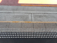
Footpath, Annandale
|
The wisdom emerging is that 30kmph is a safer speed to implement and there have been calls for this to be implemented on roads which are shared by buses, trucks, cars, bicycles and posibly other mobility devices.
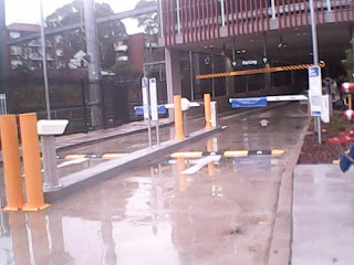 |
speed hump driveway commuter carpark, Ashfield
|
We have footpaths on most of our streets but not our laneways, so pedestrians only come into conflict with others when crossing a road or driveway.
But some footpaths are narrow eg the new shared path along Parramatta Rd Ashfield between Orpinton and Bland Sts.
 |
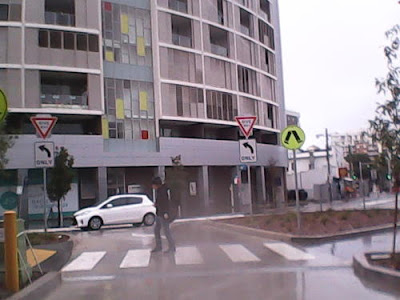
Parramatta Rd, Ashfield
|
 |
| Pedestrian Crossing driveway commuter carpark, Ashfield |
 |
Pedestrian Refuge, Crystal St, Petersham
|
 |
Edwin St, Croydon
|
Getting your Shopping Home
Shopping Trolleys (
May 23, 2019) Shoppers who walk to supermarkets are faced with the challenge of getting their shopping home...
https://perambuler.ramin.com.au/2019/05/shopping-trolleys_23.html
 |
| Shared Lane, Lane Cove |
 |
unmarked shared zone, ashfield
|
10kmph Shared Zones
Shared Paths and Roads
 |
Contrasting Shared Zone, Ashfield Station
|
 |
Taylor Lane, Annandale
|
 |
Shared Path, NSW
|
 |
shared bike parking, ACT
|
 |
Now a separated crossing, ACT
|
 |
| Shared Lane, Lane Cove |
 |
Shared Lane, Lane Cove
|
 |
Slowdown Lines, Annandale
|
 |
Shared Zone, Bay Run
|
 |
Share Path, Sutherland
|

 |
Divided Path, Bay Run
|
Traffic Lights and Pedestrian Crossings on High Speed Roads
 |
Bus Stop, Flood St, Leichhardt
|
 |
Intersection of Flood and Marion Sts, Leichhardt
|
 |
Parramatta Rd, Haberfield
|
 |
Speed Cushions Croydon Rd, Croydon
|
 |
Shared Path approaching Crossing, ACT
|
 |
| Pedestrian Refuge Croydon Rd, Croydon |
 |
Crossing has been raised and road narrowed since but speed limit still 50k Elizabeth St, Ashfield/Croydon
|

Wayfinding on Paths
Narrow Footpaths on Styles St, Leichhardt
Narrow Foopaths were idenfied in the 2021 PAMP
Local Traffic Committee Meeting APRIL 2021:Item No: LTC0421(1) Item 5
Subject: Draft Inner West Pedestrian Access and Mobility Plan (PAMP) - For Public Exhibition (All Wards / All Electorates / All PACS)
SUMMARY
Council’s Integrated Transport Strategy (ITS) identifies the need for a Pedestrian Access and Mobility Plan (PAMP) as a key action. The PAMP study aims to:
· Provide a network of safe, convenient and connected pedestrian routes which will encourage the shift from car dependency to walking.
· Enhance the pedestrian network to allow all pedestrian to enjoy safe, convenient and coherent independent mobility.
The work consisted of reviewing existing policies and strategies, future land use, reviewing historical crash data, community submissions and auditing existing pedestrian routes condition of identified priority routes. An initial community survey was also undertaken to seek the community’s insight into being a pedestrian within the LGA. This led to the development of a draft Pedestrian Access and Mobility Plan (PAMP).
The Draft PAMP has been prepared by consultant; Bitzios Consulting. The full draft report is provided in Attachment 1.
RECOMMENDATION THAT:

- The Draft Inner West Pedestrian Access and Mobility Plan (PAMP) report be received and noted; and
- The
draft report be placed on Public Exhibition, providing a minimum 28
days for community feedback and the results be reported back to the
Local Traffic Committee and CounciBACKGROUND
The
most recent PAMP was commissioned by former Ashfield Council in
2015/16. Whilst the Leichhardt PAMP was updated in 2014 and the
Marrickville PAMP was updated in 2009. Since amalgamation, there have
been a number of changes to land use, policy and infrastructure which
trigger a need to develop an Inner West PAMP. It is also an action of
Council’s integrated Transport Strategy that Council requires the
development of an Inner West PAMP for the study area comprises the
entire Inner West LGA"...
https://innerwest.infocouncil.biz/Open/2021/04/LTC_19042021_AGN_3878_AT_WEB.htm
Recent Cyclist & Pedestrian Serious Injuries & Fatalities
- Frederick St, Ashfield at John St(2017&2022)https://cityhubsydney.com.au/2022/03/safety-calls-for-inner-west-crossing-intensify-after-pedestrian-death/
- Gorges River Rd/Milton St Ashfield (2019)https://www.smh.com.au/national/nsw/pedestrian-hit-by-car-in-sydney-s-inner-west-20190401-p519jx.html
- Parramatta Rd, Leichhardt (2021)"pushing her 19-month-old baby in a pram along Parramatta Road on Sunday afternoon when a car veered onto the footpath."https://www.innerwestreview.com.au/story/7468125/locals-lay-flowers-for-valentina-gioia-killed-in-leichhardt-road-accident/
- Parramatta Road, Leichhardt (2020)https://bicyclensw.org.au/parramatta-road-rider-fatality/
- Parramatta Rd, Camperdown (2019)https://www.smh.com.au/national/nsw/cyclist-dies-after-truck-crash-on-parramatta-road-20190404-p51alb.html
- Flood St, Leichhardt (2021) https://www.innerwestreview.com.au/story/7468125/locals-lay-flowers-for-valentina-gioia-killed-in-leichhardt-road-accident/
- Norton St, Leichhardt(2021) https://www.miragenews.com/elderly-woman-hit-by-car-leichhardt-545651/
- Pedestrian critically injured in crash - Dulwich Hill (2022)intersection of New Canterbury Road and Frazer Street, POLICE NSW (Saturday, 18 June 2022 11:16:36 PM)
So once a safe speed limit is established how do we ensure it is followed - drivers follow the conditions of the road and so, it is the design of the road that they drive to.
- Narrowing lanes with line markings is a favoured cheap way
- Pedestrian Refuges
- Raised Pedestrian Crossings
- Kerb Blisters and
- Speed Cushions (humps in the old day)
Reducing Roadspace and providing land to trees, pedestrians and cyclists
 |
Reduced Road, Trees, Bikepath and Footpath, Harold Park, Forest Lodge
|


 "Research shows 30km/h speed limits on local residential streets could reduce the Australian road death toll by 13%. The economic benefit would be about A$3.5 billion every year. " -Busted: 5 myths about 30km/h speed limits in Australia, Published: May 20, 2021 5.56am AEST https://theconversation.com/busted-5-myths-about-30km-h-speed-limits-in-australia-160547


 Local Traffic Committee Meeting APRIL 2021:Item No: LTC0421(1) Item 5


Comments
Post a Comment